

Recommended Groundwater Monitoring System
Effective groundwater monitoring provides high-resolution data that helps map the spread of contaminants, track remediation efforts, and monitor groundwater levels and quality. Systems often consist of a network of sensors installed throughout a site or watershed.
Data Logger
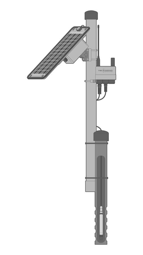
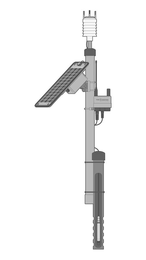
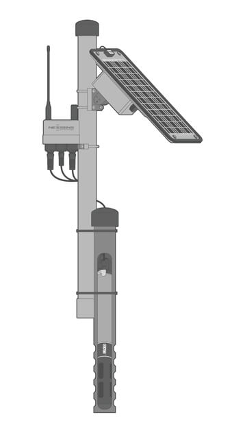
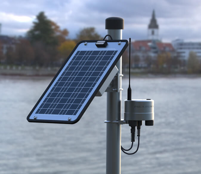
The X3 data logger is the centerpiece of groundwater networks. Pluggable sensor ports allow for simple connection of sensors, with wireless telemetry for remote data acquisition. The robust enclosure provides reliable performance in harsh environmental conditions.
Groundwater Sensors
Water quality monitoring with sondes like the YSI EXO offers a suite of parameters including conductivity, pH, ORP, DO, turbidity, and nutrients. For water level, a pressure transducer such as the Solinst Water Level Temperature Sensor is a straightforward, cost-effective option.
Power
A solar-charged SP-series power pack typically powers the X3 logger in remote telemetry applications. Solar panels are sized based on power demand and regional sunlight conditions, with battery backup for reliability in poor weather.


Need More?
NexSens offers a great deal of flexibility and customization for nearly any long-term groundwater monitoring application. Additional sensor options are available for more comprehensive measurement networks.
Weather Stations
Groundwater fluctuations are often interrelated with weather conditions, particularly precipitation rates. Rain gauges and multi-parameter weather stations are easily integrated into monitoring networks to add meteorological measurements.
Soil Monitoring
The interplay of groundwater and soil conditions can be tracked by adding soil sensors. Soil moisture profiling probes provide soil saturation rates at multiple depths, or sensors like the Stevens HydraProbe give moisture and conductivity readings at point locations.
Stormwater Tracking
Measurement of flow rates in nearby streams and rivers can provide background on the influence of stormwater runoff on groundwater levels. Systems may also include comparative water quality measurements.

Deployment
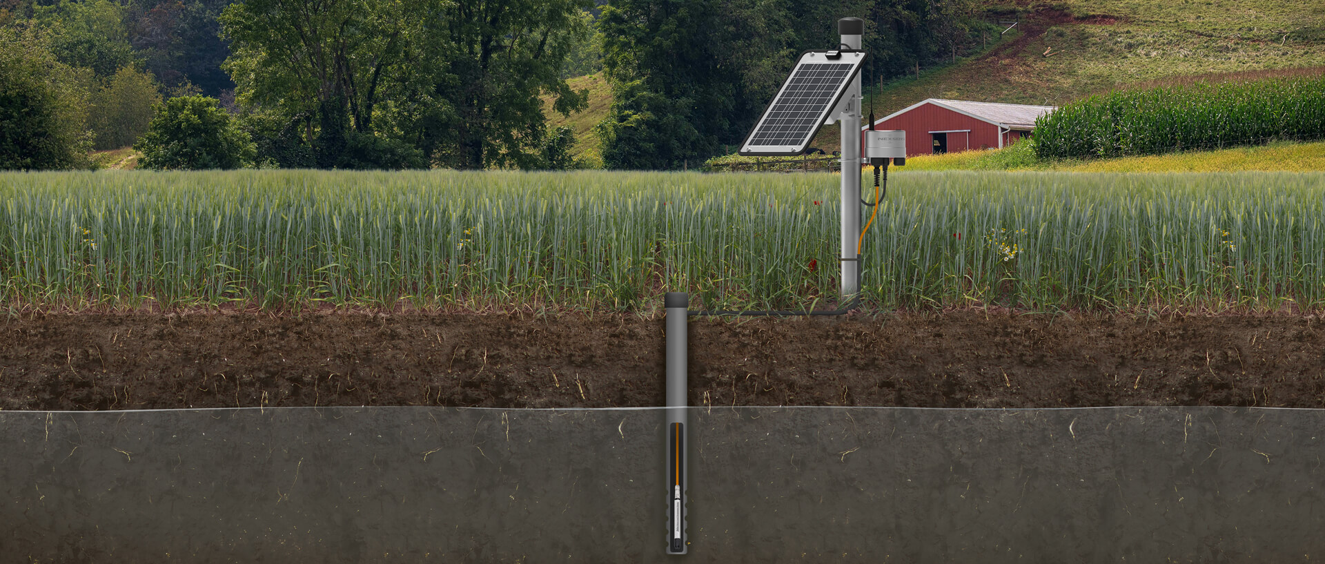
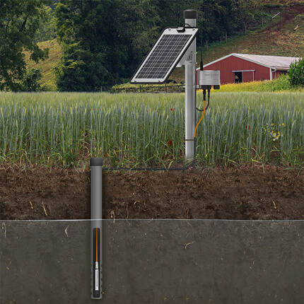
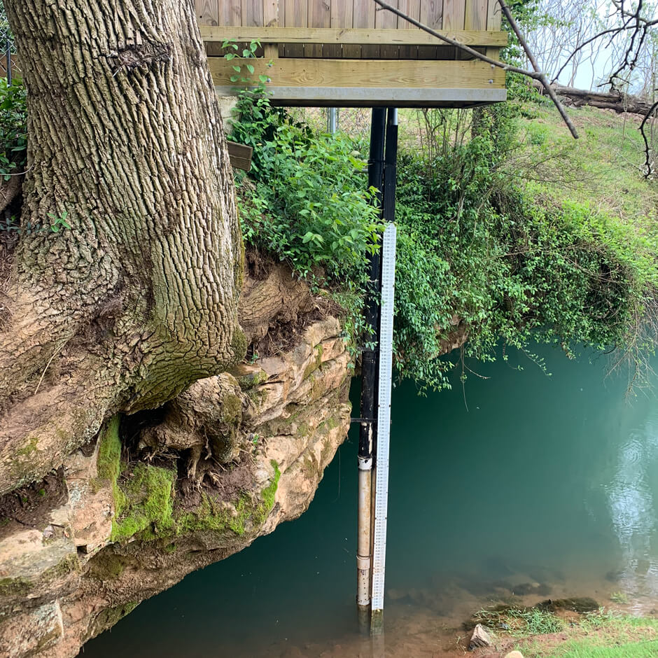
Water level sensors and water quality sondes are typically placed at the desired depth in groundwater wells using a support line suspended from the well cap to avoid cable strain. Sensors must be placed below the minimum expected water level in the well.
Sensors connect to an X-Series data logger mounted at the top of the well or on a nearby mast using the PM2 Data Logger Mounting Kit. Routing sensor cables through protective conduit helps to avoid damage.
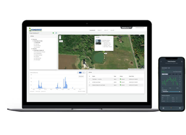
Real-Time Groundwater Data
Groundwater measurement data is transmitted in near real-time by Wi-Fi, 4G LTE, or Iridium satellite telemetry to the WQData LIVE web datacenter.
The free Basic tier WQData LIVE service allows users to view, manage, and download data sets, implement high/low Quick Alert messages for notification of exceedances, and remotely adjust data logger settings.
Subscription-based service tiers add more advanced features, including programmable alarms and data sharing options like automated export, API, or Public Portal access.
Purchase in the USA
Visit our US distributor, Fondriest Environmental, to purchase online.
Purchase Internationally
Click the button below to find a local distributor.
Contact a NexSens Applications Scientist
Need help designing an Environmental IoT system? NexSens applications scientists will help you design the perfect monitoring system to meet field conditions and monitoring needs.
Case Studies
Developing Monitoring Solutions through Applied Research
The Center for Human GeoEnvironmental Studies (CHNGES) at Western Kentucky University (WKU) works with organizations to develop environmental monitoring solutions. Dr. Jason Polk started CHNGES at WKU after recognizing a need in his industry to help create and manage long-standing environmental monitoring programs. Polk specializes in water resources and climate research, karst environments, and reconstruction of the environment. CHNGES focuses on understanding human and societal interactions as well as various environmental issues through monitoring and research. Applied research and working with communities have been the basis for all of Polk's monitoring solutions over the years. He explains, "I can study glaciers in Iceland, I can study caves in Belize, I can study, you know, groundwater right here in Kentucky, we've done work with ag communities and impacts in Vietnam—it's been really interesting and neat to be able to do work in all these different countries in these areas and see that linkage and that thread of applied research." Challenges: Innovation and Long-Term Monitoring Solutions for Unique Applications
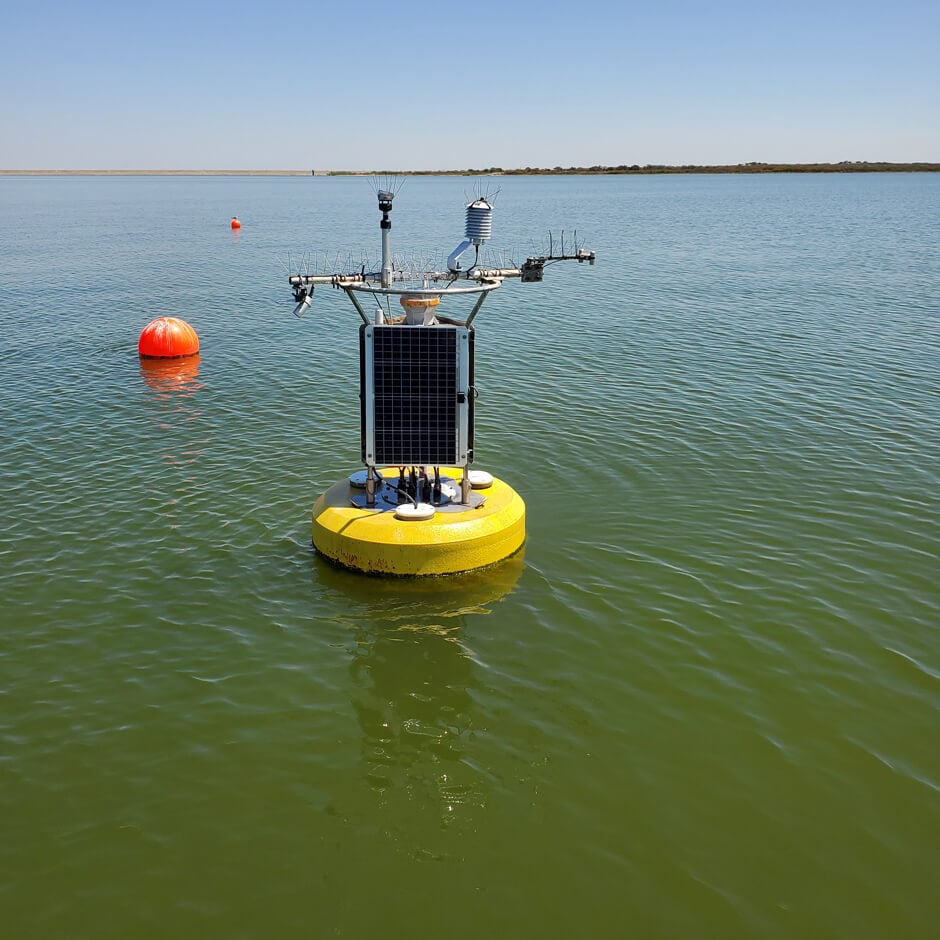
Monitoring Evaporation Rates in Texas Reservoirs
The Texas Water Development Board (TWDB) has been monitoring reservoir evaporation rates for decades. Dating back to the 1960s, the TWDB has derived evaporation rates from a sparse network of Class A evaporation stations and continues to use these systems today—with some critical additions in the form of real-time data buoys on the reservoirs. Challenge: Improving Evaporation Rate Data Accuracy Though located near the reservoirs, the pan data carried with it some uncertainties as the TWDB followed research that emerged in the 1980s and proposed that accurate estimation of reservoir evaporation required measurements be taken on the lake. In 2018, the TWDB tested this theory with an experimental floating eddy that measured the exchange of gases in a closed system and helped the TWDB better understand how climate conditions influence lake resources.