 In the 1960s, approximately 50 individual weather monitoring programs run by various independent oceanographic agencies aimed to better understand and communicate marine weather conditions for both mariners and researchers. Work began in the ‘70s to consolidate these programs and place them under control of a single agency. Today, NOAA’s National Weather Service controls and manages the National Data Buoy Center.
The mission of the NDBC is to provide “…comprehensive, reliable systems and marine observations to support the missions of the National Weather Service (NWS) and NOAA, promote public safety, and satisfy the future needs of [their] customers.”
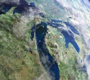
In collaboration with the NDBC, researchers at the University of Michigan’s Marine Hydrodynamics Laboratories are seeking to better understand and manage coastal resources and processes of Grand Traverse Bay. This is possible through a NOAA-funded partnership of research institutions, state and regional managers, and private sector companies interested in utilizing sensor technology for monitoring coastal environments.
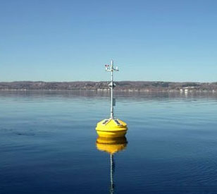
In June of 2006, a land-based weather station was added to the NDBC network to measure air temperature, relative humidity, barometric pressure, PAR, wind speed, and wind direction from the pier of the Great Lakes Maritime Academy.
Adding to a National network
 NexSens Technology was selected to provide real-time data logging and telemetry equipment, along with research-grade meteorological sensors for the land-based weather monitoring station.
RM Young weather sensors measure wind speed, direction, air temperature, and relative humidity. In addition, a Vaisala barometer and LI-COR photosynthetically active radiation (PAR) sensor were selected to meet additional weather monitoring requirements. All monitoring stations in the NDBC must measure wind speed, wind direction, gust, barometric pressure, and air temperature.
At hourly intervals, a NexSens Radio Data Logger transmits sample data via license-free spread spectrum radio telemetry to the University of Michigan’s Marine Hydrodynamics Laboratory. On the receiving end, iChart software imports this data into a centralized database. NexSens engineers implemented an automatically generated report format that allows iChart data to be sent directly to NOAA’s National Data Buoy Center website, where it can be viewed by all interested parties. View real-time data from the NDBC website.
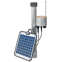
The NexSens X2 Environmental Data Logger offers the latest in real-time monitoring technology with wireless communication, large plug-and-play sensor library, and ultra-low power consumption.
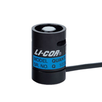
The LI-190R Quantum Sensor measures photosynthetically active radiation (PAR), which is energy that drives photosynthetic reactions in plants.
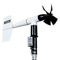
The YOUNG Serial Output Wind Monitor combines the performance and durability of the standard Wind Monitor with a unique optical encoder direction transducer and serial output.