
Large Lake Monitoring System

Large lakes and reservoirs are some of the world’s most important freshwater resources. They serve crucial roles including drinking water supply, irrigation, aquaculture, transportation and recreation. However, they are more threatened than ever by the effects of climate change and human activity. Automated monitoring systems can provide valuable information on water quality, water levels and wave conditions to protect the health of these vital resources.
Large Lakes
Large Lake Monitoring System
Large lake and reservoir monitoring systems can provide valuable data on water quality, weather conditions, wave heights, water levels, environmental cleanup efforts, thermal gradients, dissolved oxygen, and much more. This data can inform water resource managers, commercial operators and even the general public on water conditions.
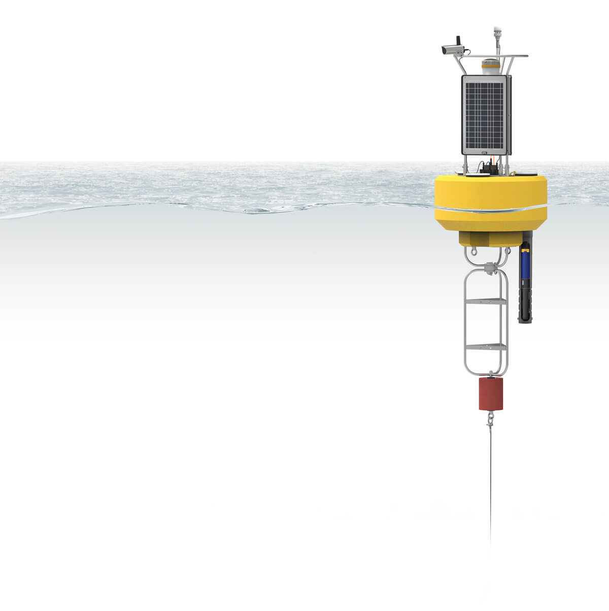
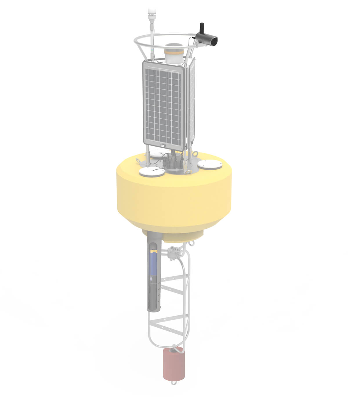
The NexSens CB-950 buoy is a powerful platform well suited for lake monitoring applications. It provides ample buoyancy and solar charging to support a significant sensor payload, but in a relatively small footprint for ease of deployment and maintenance. It supports an M650H solar marine light for night-time visibility.
For data logging, a buoy-mounted NexSens X3 environmental data logger simplifies sensor connections and transmits real-time data via 4G LTE cellular or Iridium satellite telemetry. The X3 logger is compatible with most industry-standard, multiparameter water quality sondes including those from YSI, Hydrolab, Eureka, In-situ and others. Additional sensors commonly integrated into lake systems include weather sensors such as those from Vaisala, Airmar and Lufft and NexSens T-Node FR or TS210 temperature profiling strings. Lake conditions can be monitored using current and wave sensors like the Nortek Signature series and SeaView Systems SVS-603HR, as well as camera systems that can send photos and video feeds.
The X3 logger has multiple sensor ports to accommodate large numbers of sensors with simple, waterproof UW connectors and automatic sensor detection. Data transfer to the WQData LIVE web datacenter provides options for manipulation of data, configuration of alarm notifications and presentation of research data and live conditions in a public portal.
Contact a NexSens Applications Engineer today to discuss your lake or reservoir monitoring application.


NexSens Environmental Web Camera (Coming Soon)


Purchase in the USA
Visit our US distributor, Fondriest Environmental, to purchase online.
Purchase Internationally
Click the button below to find a local distributor.
Contact a NexSens Applications Scientist
Need help designing an Environmental IoT system? NexSens applications scientists will help you design the perfect monitoring system to meet field conditions and monitoring needs.
Case Studies
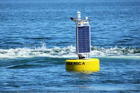
Real-Time Lake Erie Data
Presque Isle State Park gets more visitors annually than most national parks, and many of those visitors come for the area’s beaches and fishing. Before they get to the sandy, lagoon-spotted area, many check conditions online thanks to a buoy launched by the Regional Science Consortium. Locals from Erie, Pennsylvania who frequent Lake Erie’s waters off Presque Isle use the buoy’s data as well, which reveal changes to wave height and frequency in real time.
Read More About Real-Time Lake Erie Data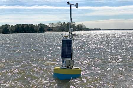
Lighter Buoys Mean Quicker, In-House Responses
The NOAA Chesapeake Bay Office runs an unusual set of buoys. NOAA’s Chesapeake buoys originated as part of the John Smith Water Trail—a kind of aquatic Appalachian Trail for boaters. Although the buoys are no longer used as interpretive trail markers, they are now part of a larger observing system of 10 full-time stations.
Read More About Lighter Buoys Mean Quicker, In-House Responses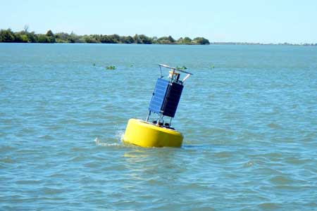
Liberty Island Restoration Project
In 2010, a design for the Liberty Island Restoration Project was completed and implemented, creating open water channels, emergent tidal marsh lands and floodplain habitats to sustain water fluctuations. The work was done in an effort to help wildlife living in the California Delta as well as fish species including delta smelt and Chinook salmon.
Read More About Liberty Island Restoration Project