
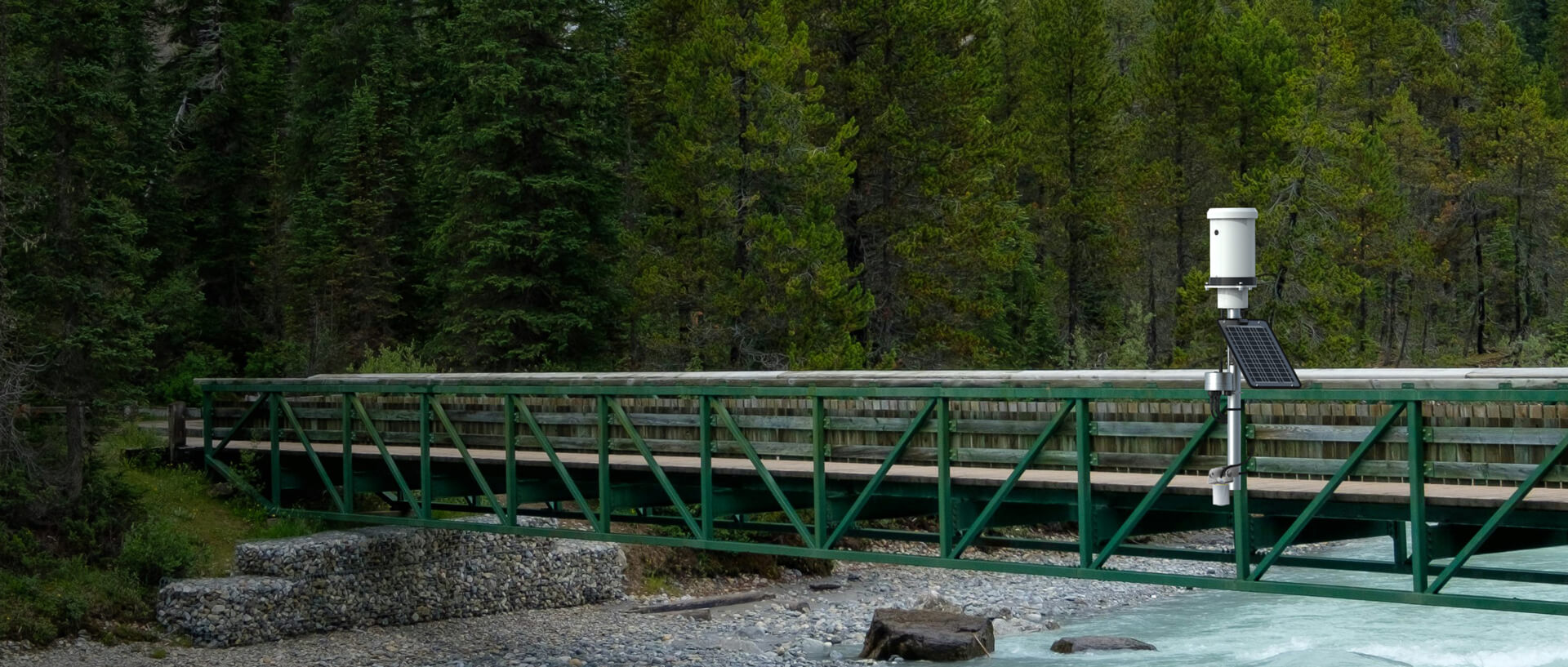
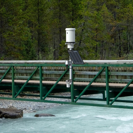

Recommended Flood Warning System
Effective flood monitoring mitigates risk using a network of flood warning stations installed throughout a watershed or at known flood-prone locations. Monitoring stations log both rainfall and water levels, as well as provide rapid warnings of changing conditions.
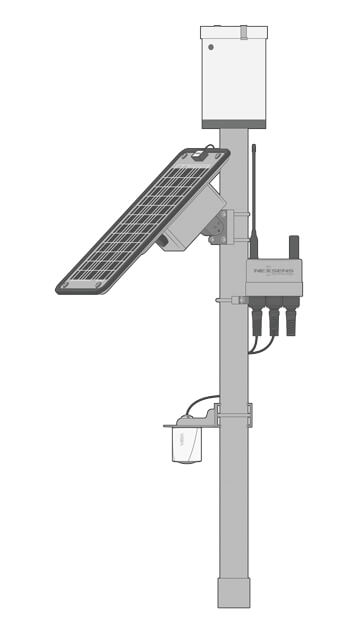
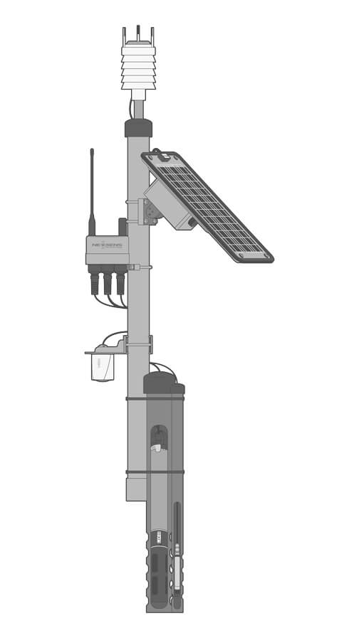
Data Logger
The X3 data logger provides reliable performance in a robust enclosure capable of withstanding extreme weather with fully waterproof, pluggable sensor connections. Wireless telemetry capabilities provide reliable data access in near real-time.
Rain Gauge
The X3 data is compatible with various precipitation sensor types. Tipping bucket rain gauges like the YSI H-3401 offer a simple and cost-effective method to monitor rainfall. Radar, acoustic, and weighing gauge sensors are also available.
Water Level Sensor
Non-contact radar devices such as the VEGA VEGAPULS C 23 radar level sensor provide accurate water level measurements in streams, rivers, reservoirs, and culverts. They require minimal maintenance and are resistant to environmental interference.
Power
System power comes from a fixed power supply or solar-charged SP-series power packs. Solar packs are sized according to sensor load and regional sunlight conditions to maintain continuous operation, with a battery for reliable performance during adverse weather.


Need More?
Flood warning systems may include supplementary sensor types for redundancy or additional parameters. The high degree of flexibility of NexSens monitoring systems allows for the gathering of comprehensive data sets in nearly any application.
Measurement Redundancy
To ensure reliable performance and corroborate sensor readings, systems can include both radar and pressure transducer sensors for redundant water level measurements. This helps validate trends, flag anomalies, and provide backup in case of sensor drift or failure.
Pressure transducer instruments like the Solinst Water Level Temperature Sensor can easily be integrated into flood warning systems. Pressure sensors are mounted below the minimum water level and are available in vented and non-vented versions.
Additional Sensors
While rain gauges are a standard component of flood warning systems, advanced multi-parameter weather stations can measure a full suite of meteorological conditions, including air temperature, pressure, humidity, wind speed and direction, and solar radiation.
Expansion with water quality sensors or multi-parameter sondes can augment system capabilities to draw correlations between water level and quality. Common parameters include water temperature, conductivity, pH, dissolved oxygen, turbidity, and algae.
Advanced Flow Measurement
Monitoring of streams and rivers can be augmented with velocity measurement to track flow conditions. The Geolux Non-Contact Flow Sensor automatically calculates flow based on user-supplied inputs of cross-sectional geometry and stream/riverbed composition.
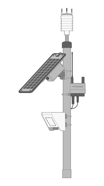

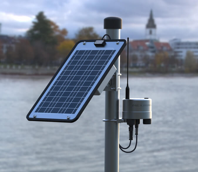
Mounting
The PM2 Mounting Kit provides versatility in mounting the X3 data logger on bridges, culverts, and other structures. It supports wall mounting with standard fasteners or attachment to 1.5″ to 2″ (38 to 50 mm) diameter poles.
Included grounding hardware protects the system against electrical surges. Custom brackets are also available for mounting radar level sensors, rain gauges, weather stations, or any other instruments integrated into a flood warning system.
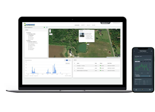
Real-Time Flood Warning Data
Wireless telemetry options, including 4G LTE, Wi-Fi, and Iridium satellite, deliver near real-time data to the WQData LIVE web datacenter from nearly any location.
Secure data access is available at no cost using the basic tier WQData LIVE service. This additionally provides features to analyze data, remotely control loggers, set simple high/low Quick Alerts, and share data through auto-reports.
Subscription-based tiers activate advanced features, including multi-trigger alarming and data dissemination via automated export, API, and Public Portal options.
Purchase in the USA
Visit our US distributor, Fondriest Environmental, to purchase online.
Purchase Internationally
Click the button below to find a local distributor.
Contact a NexSens Applications Scientist
Need help designing an Environmental IoT system? NexSens applications scientists will help you design the perfect monitoring system to meet field conditions and monitoring needs.
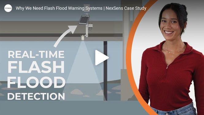
Related Videos


Case Studies

Flood Alert System
In an effort to catch and hold floodwaters in the Plum Creek watershed in Lockhart, Texas, a system of lakes, ponds, and spillways was built beginning in the 1950s. The system allows water to be released at a controlled rate, minimizing damage from heavy rains. The Plum Creek Conservation District monitors, maintains, and improves this system to ensure it works properly, maintaining 28 flood control structures and managing underground water resources in parts of both Hays and Caldwell counties. PCCD's mission is to develop and implement water conservation and management strategies to protect, conserve, and prevent waste of the groundwater resources in the district for the benefit of the citizens, economy, and environment.