
 One of the most intact watersheds in Ohio is the Scioto Brush Creek Watershed, covering an area of 274 square miles in Adams and Scioto Counties. Within the watershed, Scioto Brush Creek flows 36 miles from its headwaters in northeast Adams County to the Scioto River.
The creek is recognized by the Ohio Environmental Protection Agency as an outstanding warm water habitat. It is home to many different fish species and aquatic organisms that require high water quality for their survival. Several potential pollutants in the watershed, however, pose a threat to the stream’s health.
Like other streams around the state, non-point source pollution is the most significant cause of impairment to Scioto Brush Creek and its tributaries. Faulty septic systems, soil erosion, and illegal dumps are some of the more serious causes of non-point source pollution within the Scioto Brush Creek Watershed1.
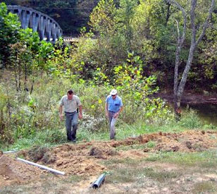
Shawnee State University’s Dr. Bob Deal, a plant biologist heavily involved in research on mitigation wetlands, was recently involved in a collaborative project to monitor environmental parameters in Scioto Brush Creek. NexSens Technology worked with Dr. Deal to design, equip, and set up a real-time weather and water quality monitoring system.
Eyes on Scioto Brush Creek
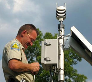 Shawnee State’s system consists of a NexSens cellular data logging system interfacing with water quality, water level, and weather monitoring instrumentation. Cellular data telemetry was selected for its cost-effectiveness and ability to transmit data from remote monitoring areas.
Mounted to the top of a two-inch-diameter galvanized steel pole, a Vaisala WXT-series multi-parameter weather sensor simultaneously measures wind speed and direction, liquid precipitation, barometric pressure, air temperature, and relative humidity. This research-grade sensor is a popular addition to real-time environmental data logging systems, due to its high accuracy measurements and low cost of ownership.
A YSI 6920 V2-2 multi-parameter water quality sonde was selected to measure water quality within Brush Creek. The instrument is securely housed within a four-inch PVC deployment pipe and simultaneously measures temperature, conductivity, pH, dissolved oxygen, and turbidity.
An OTT PS1 water level sensor is deployed nearby within a one-inch PVC deployment pipe. The PS1 continuously measures the pressure and temperature of water, compensating for effects in temperature and relative density to output high accuracy water level measurements.
With NexSens data telemetry, software, and web hosting, Shawnee State researchers and other local Brush Creek Watershed conservationists have real-time access to previously unavailable data. NexSens’ WQData web datacenter provides open-access watershed data via the Internet using any standard web browser. Information gathered will be used to better understand and preserve the water quality of Scioto Brush Creek.
The project is part of a collaborative effort between five Ohio institutions: Ohio State University, Wright State University, Shawnee State University, Central State University, and Kenyon College. Real-time data from each of these institutions is available at The Ohio State University’s Olentangy River Wetlands Research Park in Columbus.
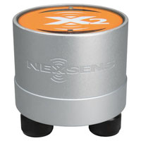
The NexSens X2 Environmental Data Logger offers the latest in real-time monitoring technology with wireless communication, large plug-and-play sensor library, and ultra-low power consumption.
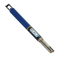
The YSI EXO represents the next generation of water quality instruments from YSI. The EXO1 sonde includes four sensor ports with internal data logging and battery power.
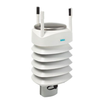
The Vaisala WXT536 Multi-Parameter Weather Sensor simultaneously measures air temperature, humidity, pressure, rainfall and wind in a compact platform with optional heating.

WQData LIVE is a web-based project management service that allows users 24/7 instant access to data collected from remote telemetry systems.