Turbidity Monitoring During Dredging Operations

Dredging is a common practice for removal of contaminated sediment for remediation under CERCLA, commonly called the “Superfund” program, or for maintenance and expansion of ports, harbors and shipping channels. Real-time turbidity monitoring during the dredging operation provides needed data to aid in decision making and ensure minimal environmental impact.
Dredging and Environmental Impacts
Typical Turbidity Monitoring System
Buoy based systems are most commonly used for dredging operations. They are easy to deploy and relocate as needed. Flexible mooring options allow for deployment in almost any location.
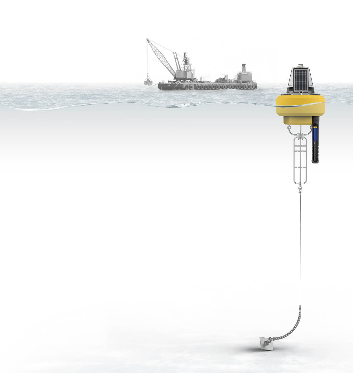
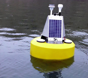
The NexSens CB-450 buoy is an ideal platform for dredge turbidity monitoring. It is light enough to be deployed from most small boats, yet large enough to provide sufficient power in medium to long-term applications with its on-board battery and three solar panels. It supports an M550 solar marine light for night-time visibility.
For data logging, a buoy-mounted NexSens X3 environmental data logger simplifies sensor connections and transmission of real-time data to the WQData LIVE web datacenter, where alarms are configured to provide notice when critical thresholds are exceeded. The X3 logger is compatible with most industry-standard turbidity sensors including those from YSI, Campbell, Eureka, In-situ and others. The logger has multiple sensor ports to accommodate situations where sensors are placed at various depths.
Short-term applications can often be covered by the simpler CB-75 data buoy with an X3-SUB data logger. This provides all of the same functionality of a comparable CB-450 system but in a small and lightweight system that is simple to deploy.
In situations where additional parameters are required, the X3 data logging platform supports a variety of additional sensors for measurement of water quality, weather conditions, currents and more.
Contact a NexSens Applications Engineer today to discuss your dredge turbidity monitoring application.


Case Studies
Snake River Dredge Turbidity Monitoring
The Snake River flows through parts of Washington and Idaho and is an important lane for transportation and shipping goods in the Pacific Northwest. But, over time, its value is impacted by sediment buildup that slows transportation down. The U.S. Army Corps of Engineers, charged with providing safe and reliable means of transportation throughout the United States’ many important channels and waterways, typically steps in to dredge the river when sediment levels get too high. Key to successful dredging projects is monitoring turbidity levels to make sure that fish and other aquatic life aren’t adversely affected by operations.
Read More
Northern Caspian Sea Dredging
Kazakhstan is a country not often associated with having a shoreline, let alone a marine environment. However, in the western corner of Kazakhstan lies a section of coastline along the Caspian Sea. Through a network of rivers and channels, the Caspian Sea is actually connected to the trade routes of the world’s oceans. To support the expanding oil fields of Western Kazakhstan, a deep-water port is being constructed in the Northern Caspian Sea. The project has many challenges, including bringing ocean-going vessels into the shallow waters of the Northern Caspian. Averaging 2 meters water depth throughout much of the region, a large-scale dredging project has begun to dig a shipping channel over 60 kilometers long.
Read More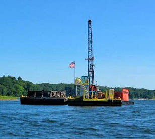
Turbidity Dredge Monitoring
A large Midwest consulting firm was contracted to remove contaminated sediments from an embayment of Lake Michigan. The firm was required to monitor turbidity at two depths and five locations surrounding the dredge in order to ensure contaminated sediment levels did not exceed a specified range in the water. If sediment levels fell outside of the range, the dredge operator would have to be notified to slow down or alter the dredging operation. As an embayment of Lake Michigan, with significant wave action and harsh weather conditions, the dredge site offered significant challenges for deploying and maintaining the monitoring sensors.
Read More