
Drifting Buoys

Unlike traditional moored data buoy concepts, drifting buoys facilitate study of oceans by recording measurements as they move freely with currents and weather systems. Sometimes simply referred to as drifters, the unique data collected by these buoys helps to enhance our understanding of ocean patterns, track long-term changes, and provide real-time data that can be used in forecasting and modeling.
Drifting Buoy Measurements
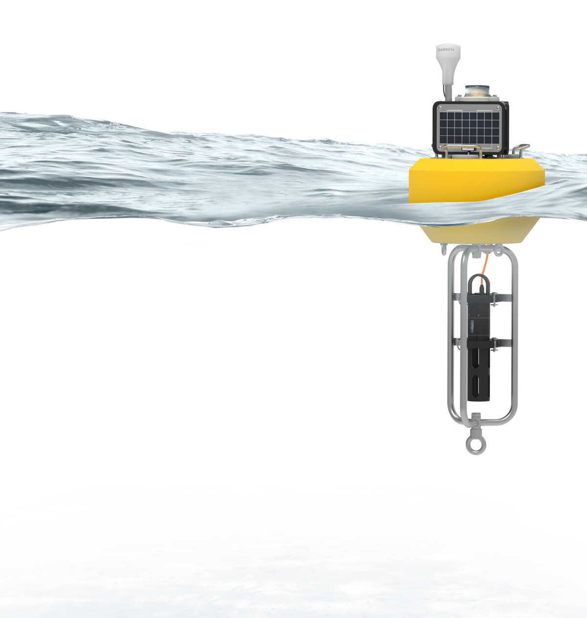
Typical Drifting Buoy System
Drifting buoys are typically compact, relatively low-cost and easy to deploy systems equipped with various sensors for measurement of water and meteorological parameters. Measurement data supports research, forecasting and other applications for monitoring both real-time conditions and long-term trends. Satellite telemetry with geopositioning data is standard on most drifting buoys for mapping of collected measurements and tracking the buoy’s location.
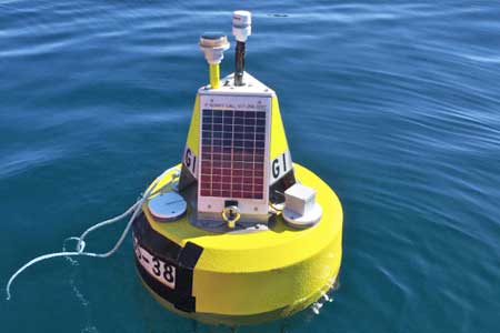
NexSens offers flexible drifting buoy options based around the CB-75 data buoy with X3-SUB submersible data logger. With a diameter of 21” (53.3 cm) and total weight of just 40 lb (18.2 kg), the CB-75 is simple to deploy and retrieve. Three wet-mate connectors combined with the processing power of the X3 allow for secure, waterproof connection of a wide range of measurement instruments.
Sea surface temperature, salinity, waves, currents, barometric pressure, and wind speed and direction are some of the most common observations recorded. For wave measurement, the SeaView Systems SVS-603 wave sensor can be directly integrated into the data logger canister to report wave height, period and direction data. NexSens T-Node FR sensors can measure surface temperature or be integrated in strings for multi-point profiling. Multiparameter sondes such as those from YSI, Hydrolab, Eureka and In-situ measure a multitude of water quality factors, and similar flexibility in meteorological measurements is possible with compatible sensors from Airmar, Vaisala, Lufft, Gill, RM Young and others.
Depending on sensor configuration and measurement intervals, NexSens drifting buoys can operate continuously during extended deployments thanks to the 4W solar panels of the CB-75 and internal battery pack. On-board Iridium satellite communications in the X3-SUB data logger transmit data to the WQData LIVE web datacenter. In a basic configuration, this free service allows users to securely access and analyze data, as well as share data through auto-reports. Subscription-based tiers of WQData LIVE are also available for advanced reporting, alarming, and data sharing including automated export, API and public portal options.
Contact a NexSens Applications Engineer today to discuss your drifting buoy application.


Purchase in the USA
Visit our US distributor, Fondriest Environmental, to purchase online.
Purchase Internationally
Click the button below to find a local distributor.
Contact a NexSens Applications Scientist
Need help designing an Environmental IoT system? NexSens applications scientists will help you design the perfect monitoring system to meet field conditions and monitoring needs.
Case Studies
Sturdy Little Buoy, Tremendous Predictive Power
Two solitary data buoys floating off the storm-tossed Lake Superior shore near Munising and Granite Island were sudden stars in 2017. That October, they captured the largest waves ever measured on the Great Lakes—each 28.8-foot high—during a storm that claimed the lives of two people swept off rocks. This attention-getting event shows how buoy data help managers and the public comprehend the otherwise unimaginable force of a wild Lake Superior storm that caused six figures in damage along the coast. However, these beacons provide critical wave data throughout the field season, even when the waves aren’t quite so formidable.
Read More About Sturdy Little Buoy, Tremendous Predictive Power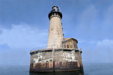
A New Kind of Sentinel on Lake Superior
For more than 100 years, the Stannard Rock Lighthouse has kept a watchful guard over Lake Superior. But now, a new weather buoy is joining the watch in a remote part of Lake Superior, providing much-needed weather data to local mariners, the National Weather Service (NWS), and researchers. Scientists from the Superior Watershed Partnership (SWP), Lentic Environmental Services (LES), and the University of Colorado-Boulder deployed the buoy on the lake in 2017. Since then, it has provided continuous data from one mile north of the lighthouse.
Read More About A New Kind of Sentinel on Lake Superior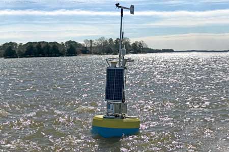
Lighter Buoys Mean Quicker, In-House Responses
The NOAA Chesapeake Bay Office runs an unusual set of buoys. NOAA’s Chesapeake buoys originated as part of the John Smith Water Trail—a kind of aquatic Appalachian Trail for boaters. Although the buoys are no longer used as interpretive trail markers, they are now part of a larger observing system of 10 full-time stations.
Read More About Lighter Buoys Mean Quicker, In-House Responses