
 Similar to how shipping vessels are getting larger and larger these days, cruise ships have too. Newly designed cruise vessels are longer, wider and packed with more amenities to give guests the best trips possible. But there are costs to larger ships moving in and out of the world’s ports.
In Bermuda, an island nation whose economy runs on tourism, its ports have felt the impacts of the shift. Government officials there eventually realized that the larger cruise ships in construction these days simply couldn’t squeeze through their navigation channels.
In response to this, the officials contracted a dredging company to clear out the nation’s North Channel area in October 2015. To minimize environmental impacts of the dredging operations, the government worked with CH2M HILL, an environmental consultant, to oversee monitoring efforts around the dredge. CH2M HILL contracted Bermuda Environmental Consulting to carry out monitoring around the operations, relying on NexSens data buoys to complete the work.
Easily deployable buoys for project needs
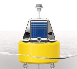 Five NexSens CB-150 Data Buoys were selected for the work. The buoys were rented, along with all other equipment used, since the project’s time frame didn’t necessitate purchasing equipment outright. These were ideal for the North Channel’s wave actions and were compact enough to suit routine deployment and re-deployment around dredging areas.
At least one buoy was in the water at all times, with two buoys commonly launched above the dredge while another two carried out monitoring below it. Of interest to those involved with the project were turbidity levels. If they got too high, then dredging operations would have to be stopped to protect aquatic life nearby.
On the topside of all CB-150 data buoys are solar panels that provide continuous power to onboard electronics and data loggers. For the Bermuda North Channel project, engineers also opted to use Garmin GPS 19x HVS GPS receivers on each buoy so that they could know where buoys were located with respect to the dredge at all times. These were mounted on topside mounting plates along with solar marine lights that served as beacons to alert others of the platforms’ locations on the water.
On the bottomside of each buoy, deployed securely in 2-inch pass-through ports, were YSI 600OMS Optical Turbidity sondes. These gathered data on water temperature, conductivity and turbidity. Measurements were logged by NexSens X2-CB Buoy data loggers within each CB-150 and then transmitted to a NexSens WQData LIVE Web Datacenter every 10 minutes via Iridium satellite telemetry. By using this datacenter, project managers were able to configure alarms and alerts to immediately let them know if turbidity levels got too high and dredging needed to be stopped.
Lastly, as a data redundancy measure, project managers used a YSI 650 MDS Multi-Parameter Display System with a 600OMS sonde to spot-check reported turbidity levels as needed.
Cruise ship photo courtesy of Yankeesman312
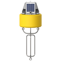
The NexSens CB-150 Data Buoy is designed for deployment in lakes, rivers, coastal waters, harbors, estuaries and other freshwater or marine environments.
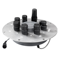
The X2-CB is a fully featured data logger housed inside a waterproof enclosure specifically designed to integrate with NexSens’ CB-Series data buoys.
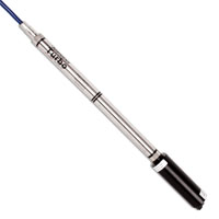
Seametrics’ Turbo turbidity logger measures a wide range of NTUs, making it a versatile device capable of deployment at many different sites.
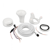
The highly accurate GPS 19x HVS position receiver/antenna provides up to 10 Hz update rates for position, velocity and time data.

WQData LIVE is a web-based project management service that allows users 24/7 instant access to data collected from remote telemetry systems.