
Port and Harbor Monitoring

Ports and harbors are the critical nodes in our modern global economy. While they provide safe haven from the open seas, they are not without hazards. Port and harbor monitoring systems can measure weather, waves and currents to help to ensure that ship traffic can safely navigate the waters. They can also monitor water quality during dredging and other construction activity to ensure that the environment and ecosystems remain protected.
Ports and Harbors

Port and Harbor Monitoring System
Safety in heavily trafficked areas depends on many factors. Shoreside and buoy-based port and harbor monitoring systems play a critical role in tracking many of these, including weather conditions, waves, water currents, depths to bottom, and water quality.
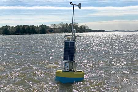
A typical NexSens port and harbor monitoring system consists of dockside and/or buoy-based measurements using a platform such as the CB-1250 data buoy, which is large enough for good visibility and can support mounting of special marks like a St. Andrew’s cross or custom equipment such as an AIS system. The X3 data logger is the central component of either type of deployment. It is compatible with a wide range of sensor types and transmits real-time data via wireless telemetry.
For water current monitoring, an acoustic Doppler current profiler (ADCP) instrument such as a Nortek Aquadopp or Signature series instrument may be used. These can measure currents at a single point in the water column or profile in a series of cells from near-surface to bottom. Wave measurement, including statistical values for significant and maximum wave height, direction and period, is simple to add using the SeaView Systems SVS-603HR wave sensor mounted in a watertight enclosure atop the buoy data logger. Depth to bottom on a buoy platform can be tracked using an Airmar EchoRange SS510 sonar depth sensor.
In cases such as dredging or for general water quality monitoring, the X3 data logger is compatible with nearly all industry standard turbidity sensors and multiparameter water quality sondes including those from YSI, Hydrolab, Eureka and In-situ. For more information on turbidity, see the Dredge Turbidity Monitoring systems page.
Regardless of sensor selection, data transfer to the WQData LIVE web datacenter provides options for viewing, manipulation, reporting and exporting of data, configuration of alarm notifications, data API, and more.
Contact a NexSens Applications Engineer today to discuss your port or harbor monitoring application.


Purchase in the USA
Visit our US distributor, Fondriest Environmental, to purchase online.
Purchase Internationally
Click the button below to find a local distributor.
Contact a NexSens Applications Scientist
Need help designing an Environmental IoT system? NexSens applications scientists will help you design the perfect monitoring system to meet field conditions and monitoring needs.
Case Studies
Lighter Buoys Mean Quicker, In-House Responses
The NOAA Chesapeake Bay Office runs an unusual set of buoys. NOAA’s Chesapeake buoys originated as part of the John Smith Water Trail—a kind of aquatic Appalachian Trail for boaters. Although the buoys are no longer used as interpretive trail markers, they are now part of a larger observing system of 10 full-time stations.
Read More About Lighter Buoys Mean Quicker, In-House Responses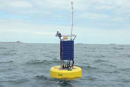
Developing Alaska Buoy Platform
Loss of sea ice in the Arctic due to climate change is leading many to anticipate that the Arctic will become a more popular shipping route. With the expected increase in use, agencies such as the National Oceanic and Atmospheric Administration (NOAA) are preparing for more operations in the region. For NOAA, that means testing and developing new ways to monitor in the region’s waters.
Read More About Developing Alaska Buoy Platform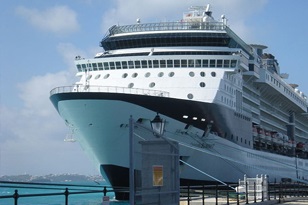
Bermuda North Channel Dredging
Similar to how shipping vessels are getting larger and larger these days, so have cruise ships. Longer, wider vessels pack more guests and amenities, but there are costs to larger ships moving in and out of the world’s ports. In Bermuda, an island nation whose economy runs on tourism, government officials there realized that new, larger cruise ships simply couldn’t squeeze through their navigation channels.
Read More About Bermuda North Channel Dredging