
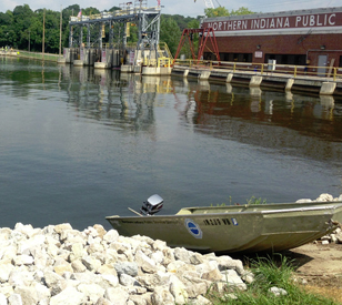
 The Northern Indiana Public Service Company (NIPSCO) is a large energy provider in the state of Indiana. It provides power to more than a million customers through distributing energy derived from natural gas and hydropower dams.
As part of achieving its mission to provide reliable energy to its customers, officials at the company have to be aware of changing flow rates near its hydropower assets. The real-time calculations are necessary for keeping plant managers up to speed on factors that could influence hydropower output.
To meet the need for quality data tracking flow, officials at NIPSCO contracted engineers at LimnoTech, an environmental consulting company based in Ann Arbor, Michigan, to devise a monitoring solution. Project managers at LimnoTech then collaborated with specialists at NexSens Technology to equip vital hydropower areas with water level sensors and cellular data loggers.
Going with the flow
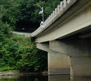 There are four areas that NIPSCO officials need to monitor on an ongoing basis, all of which are located along Indiana’s Tippecanoe River or the downstream Wabash River. To make things a little simpler, they opted to deploy flow-tracking equipment on existing bridges along the waterway.
With the spots picked out, project managers determined the best data loggers for the job were NexSens Technology data loggers equipped with cellular telemetry and housed in a secure box. Part of the reasoning behind the choice included the sturdy stainless steel box for each AVSS Wireless Telemetry System, which minimizes risks of vandalism. Project managers secured eight telemetry systems, two for each bridge monitoring site.
A pair of data logging systems are mounted to each bridge along with solar panels for power. Deployed below each logger is a WaterLOG H-3613 Radar Water Level Sensor capable of measuring the river’s level below without making contact with its surface. The non-contact measurements are possible thanks to antennas within the WaterLOG sensors that use advanced distance-measuring technology.
After the level measurements are captured by the WaterLOG sensors, data are transmitted via cellular telemetry to a computer running NexSens iChart software. The software displays the figures on water level with updates every 15 minutes.
LimnoTech engineers have also been periodically collecting discharge measurements using a SonTek RiverSurveyor M9 ADCP. Plugging this discharge data into iChart Software alongside the water level data allows NIPSCO engineers to automatically estimate river flow in real time.
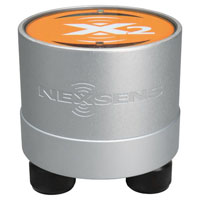
The NexSens X2 Environmental Data Logger offers the latest in real-time monitoring technology with wireless communication, large plug-and-play sensor library, and ultra-low power consumption.
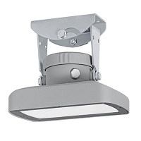
The OTT RLS, non-contact radar level sensor with pulse radar technology is ideal for monitoring in remote or hard to reach locations.
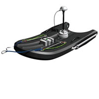
RiverSurveyor M9 Floating Acoustic Doppler Current Profiler