
 Kazakhstan is a country not often associated with having a shoreline, let alone a marine environment. However, in the western corner of Kazakhstan lies a section of coastline along the Caspian Sea. Through a network of rivers and channels, the Caspian Sea is actually connected to the trade routes of the world’s oceans.
To support the expanding oil fields of Western Kazakhstan, a deep-water port is being constructed in the Northern Caspian Sea. The project has many challenges, including bringing ocean-going vessels into the shallow waters of the Northern Caspian. Averaging 2 meters water depth throughout much of the region, a large-scale dredging project has begun to dig a shipping channel over 60 kilometers long. In order to minimize the environmental impacts of the dredging activities, oceanographic and meteorological data is needed not only to monitor the daily conditions, but also to support the long-term modeling of the disposal material.
Since 2013, Gravity Consulting has been working with a team of scientists to support the monitoring, tracking and modeling of the ongoing marine construction as well as the ultimate fate of disposed dredge material.
Real-time data in the Caspian Sea
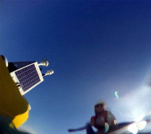
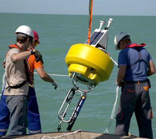 To meet the demands of actively monitoring meteorological and oceanographic data as the environmental conditions change, the Nexsens CB-450 buoy was chosen as the ideal data collection platform to meet project challenges. The buoy is small and light enough to be deployed by low-draft vessels, but sturdy enough to withstand the high winds and short-period waves that persist in the project region.
Each buoy was outfitted with the Airmar 150WX Ultrasonic WeatherStation (measuring wind speed/direction, GPS, atmospheric pressure), an Airmar EchoRange SS510 depth sensor (water depth), and YSI EXO 2 Multi-Parameter Water Quality Sonde measuring turbidity, conductivity and temperature. Additionally, each buoy was paired with an Iridium satellite modem, which transmitted data every hour to an internet portal for real-time data viewing and analysis.
The buoys have performed exceptionally well and have seen a wide range of conditions throughout the dredging season. The data collected was imperative to both the collection of background conditions, and monitoring environmental conditions during in-water construction.
The real-time data service also proved valuable for real-time decision making and vessel logistics. Being able to monitor water levels and weather conditions allowed for informed decisions on vessel operations and general survey planning.
The pairing of the CB-450 with the Iridium satellite modem proved to be an excellent instrument for the unique conditions of the Northern Caspian Sea, and met the demand for access to real-time data from managers and clients.
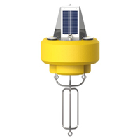
The NexSens CB-450 Data Buoy is designed for deployment in lakes, rivers, coastal waters, harbors, estuaries and other freshwater or marine environments.
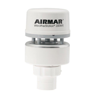
The Airmar 150WX is a compact weather station ideal for moving platforms. The sensor outputs apparent and true wind, barometric pressure, air temperature, GPS location, and more.
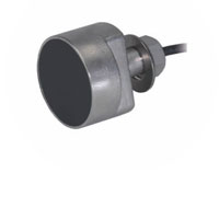
The Airmar EchoRange SS510 Smart Sensor is a low-cost depth sonar for bridge scour monitoring, sediment transfer studies, and portable hydrographic surveys.
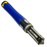
The YSI EXO represents the next generation of water quality instruments from YSI. The EXO2 sonde includes six sensor ports and a central anti-fouling wiper option.