
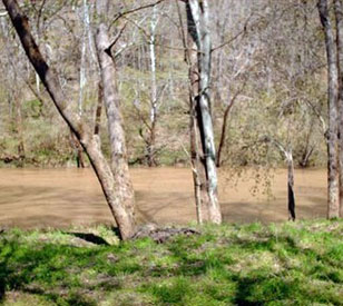
 Spread across 671 acres of land in Hart County, Kentucky, the Upper Green River Biological Preserve is a diverse habitat consisting of bottomlands, uplands, barrens, caves, limestone glades, and the Green River itself. The preserve was acquired through the Kentucky Heritage Land Conservation Fund and formally established by Western Kentucky University in early 2004.
In the interest of advancing research and education on the preserve, WKU recently began a project to design and implement a real-time water quality and water level monitoring network throughout the territory. University researchers chose NexSens real-time data logging systems as a remote monitoring solution.
Low-maintenance monitoring system
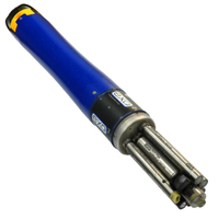
The initial field site was deployed along the Green River to monitor both water level and water quality parameters. A YSI 600OMS (Optical Monitoring System) V2 sonde is deployed within a 2″ PVC deployment pipe into the river. This instrument is set up to periodically measure temperature, conductivity, turbidity, and water level. This combination of parameters creates a low-maintenance, high-accuracy monitoring system.
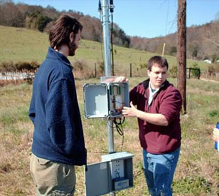
Since cellular coverage was unavailable at this field site, a NexSens data logger with spread spectrum radio telemetry was installed on site. The logger transmits data via license-free radio to a nearby radio-to-cellular system where cellular coverage is adequate. This logger receives data from the site via radio and transmits it via cellular telemetry to the project coordinator’s office at WKU’s Bowling Green campus.
iChart software is installed on the coordinator’s office PC for direct communication to the remote systems. iChart offers a unique feature that allows the user to access the YSI sonde terminal remotely. This gives project members the opportunity to change parameter reporting, check calibration constants, and adjust sonde settings, all without visiting the site.
iChart software is set up to automatically post retrieved data to WQData, an online web datacenter service offered by NexSens Technology. The datacenter will eventually be opened to the public, allowing both researchers and students to view real-time project data from virtually anywhere.
As additional site locations are identified and set up, Western Kentucky University and other interested parties can use the real-time information to better understand and help protect this unique biological preserve.
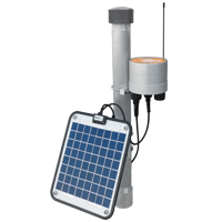
The NexSens X2 Environmental Data Logger offers the latest in real-time monitoring technology with wireless communication, large plug-and-play sensor library, and ultra-low power consumption.
The YSI EXO represents the next generation of water quality instruments from YSI. The EXO2 sonde includes six sensor ports and a central anti-fouling wiper option.

WQData LIVE is a web-based project management service that allows users 24/7 instant access to data collected from remote telemetry systems.