

How Do You Monitor Turbidity During Dredging In Real Time?
Recommended Dredge Turbidity Monitoring System
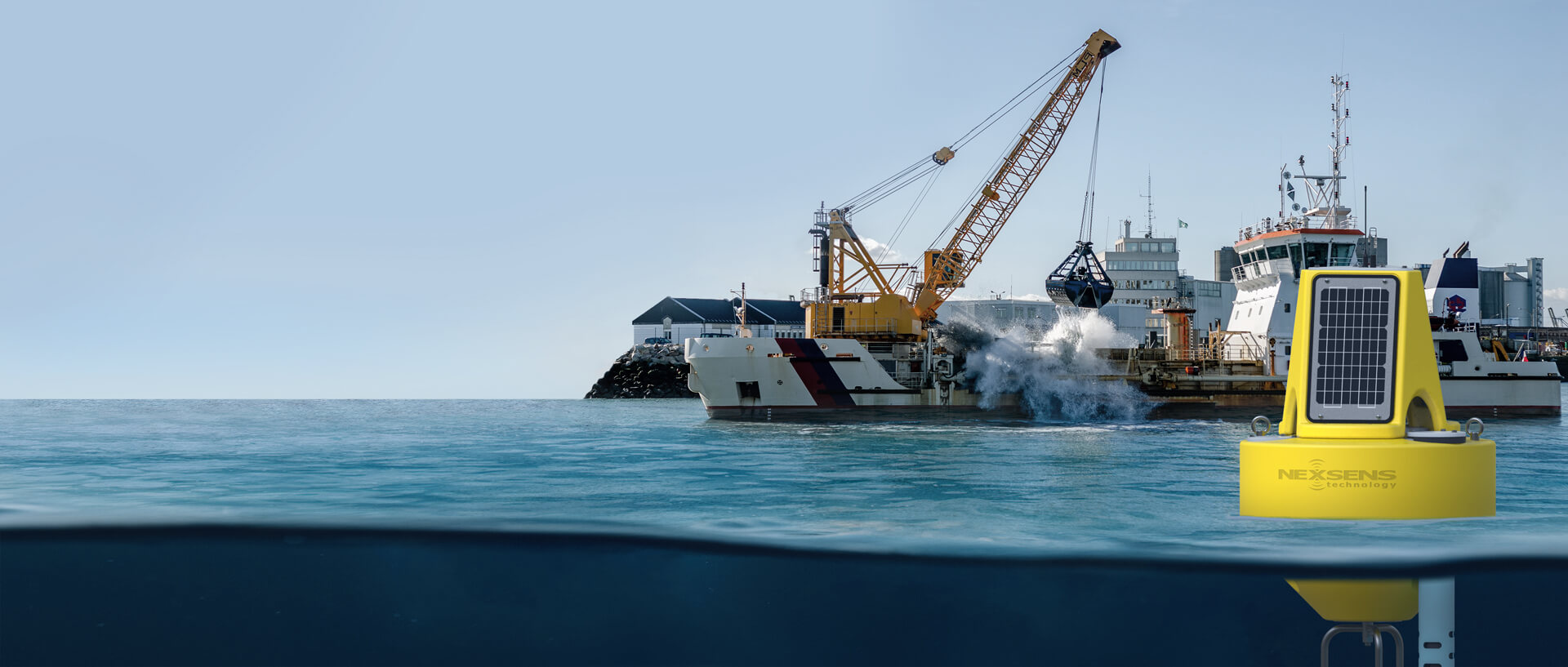
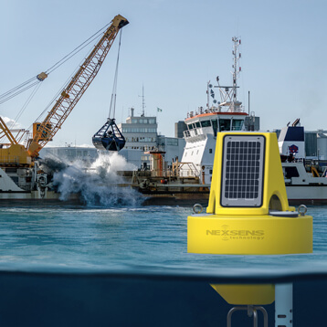
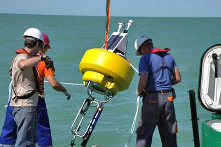
Dredging operations require reliable data and robust equipment that works in various environments, such as lakes, rivers, ports, and harbors. Buoy-based systems with wireless telemetry are optimal for flexible placement in open water.
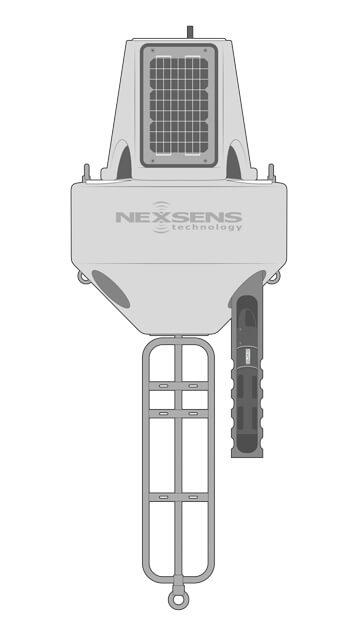
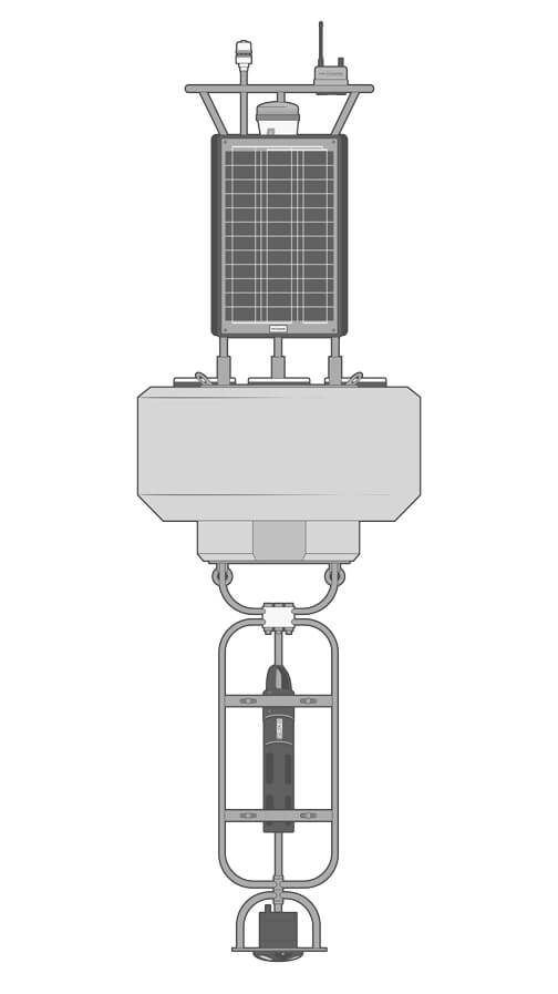
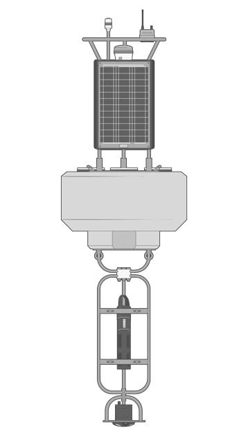
Buoy
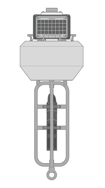
The XB-200 buoy is a compact, robust, and powerful platform ideal for most dredge turbidity applications. It is large enough for visibility to equipment operators and ship traffic, but at just under 70 lb (30 kg), it can be easily moved as needed during dredging operations.
Data Logger
The X3 data logger provides pluggable, waterproof ports for simple and reliable sensor connections, with automatic sensor detection to simplify setup. It easily mounts to the buoy solar tower and transmits real-time data via Wi-Fi, 4G LTE, or Iridium satellite telemetry.
Turbidity Sensors
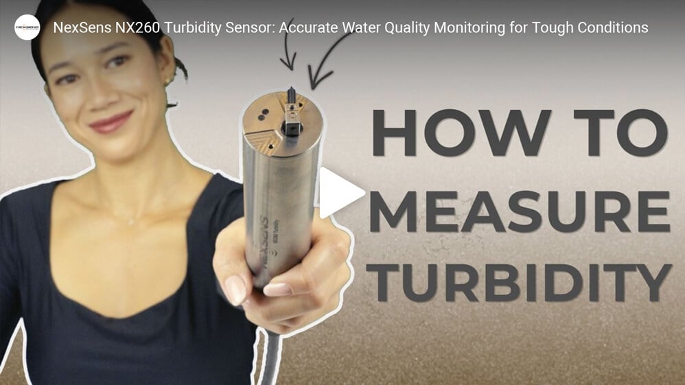
The X3 logger is compatible with most turbidity sensors from leading manufacturers using industry-standard communication protocols. Wiped sensor systems, such as the NexSens NX260 and YSI EXO3s are essential for cleaning sensor optics during extended deployments.
Power
Three 15W solar panels and up to 56 A-hr battery capacity on the XB-200 data buoy allow for high-frequency turbidity data acquisition. The solar panels capture sunlight from any direction and support continuous operation in most geographic locations.
Accessories
For near-surface monitoring, a perforated deployment pipe accessory protects the turbidity sensor while allowing topside access for simple cleaning and maintenance. Suspended sensor strings can easily be attached to the buoy for deeper or multi-sensor configurations.


Need More?
NexSens monitoring systems offer a solution for dredging projects of any scale. Turnkey systems come in a range of sizes and support additional sensor types for applications requiring additional measurement types.
Alternate Buoy Sizes
For short-term dredging projects in locations where buoy visibility is not a critical factor, the compact and lightweight CB-75 is a cost-effective alternative. It supports the same turbidity sensor types as any larger buoy system.
For busy ports or any situation requiring advanced instrumentation with a higher power demand, larger buoy platforms like the CB-650 and CB-950 are available. These also improve visibility with a larger beacon and radar reflector option.
Additional Sensors
Common sensor types used on dredge turbidity buoys include weather stations, water quality sensors, and current profilers. Meteorological instruments mounted on the buoy tower offer real-time data on local weather conditions at the dredging site.
In cases where the larger impact of turbidity on general water quality should be monitored, additional water quality sensor types and multi-sensor sondes can be integrated. These can measure parameters including temperature, pH, dissolved oxygen, and nutrients.
Potential turbidity releases from dredging sites may be tracked using ADCP current profilers. These advanced instruments provide information on current speed and direction at multiple depths and output real-time data alongside turbidity measurements.
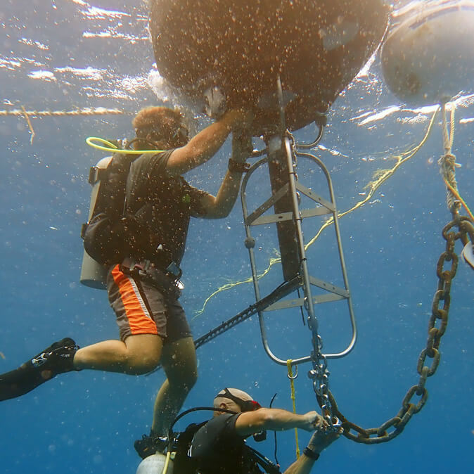
Deployment
Monitoring buoys at dredging sites use either single-point or two-point mooring configurations. Sites with calm, shallow waters and buoy-mounted sensors work well with single-point moorings, while two-point moorings more easily facilitate suspended sensor strings.
Shoreside deployments are also possible, for example, from riverbanks, piers, or docks. The X3 is mounted to a pole, wall, or other structure with the PM2 Mounting Kit and receives power from a SP-series solar power pack.
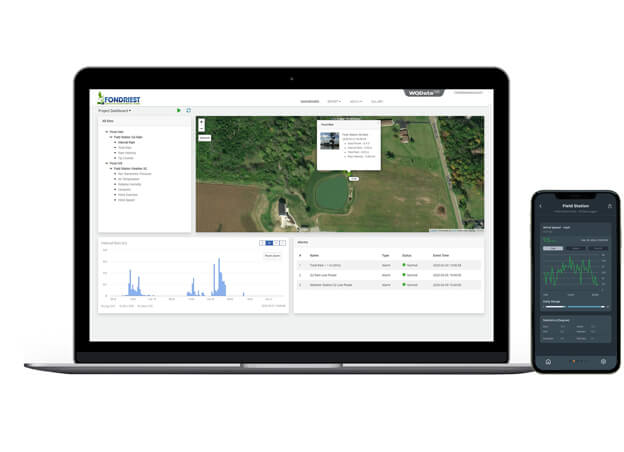
Real-Time Lake Data
Turbidity measurements are delivered in near real-time to the WQData LIVE web datacenter for continuous monitoring throughout dredge operations.
The free, basic tier service option includes secure data access with simple high/low Quick Alert notifications to inform of turbidity exceedances, as well as tools for remote data logger configuration and data analysis, sharing and downloading.
Subscription-based WQData LIVE tiers include features for more advanced alarms based on multi-trigger conditions or consecutive turbidity readings over threshold values. Data sharing via automated export, API, or Public Portal is also available.
Purchase in the USA
Visit our US distributor, Fondriest Environmental, to purchase online.
Purchase Internationally
Click the button below to find a local distributor.
Contact a NexSens Applications Scientist
Need help designing an Environmental IoT system? NexSens applications scientists will help you design the perfect monitoring system to meet field conditions and monitoring needs.
Related Videos

Case Studies
Northern Caspian Sea Dredging
Kazakhstan is a country not often associated with having a shoreline, let alone a marine environment. However, in the western corner of Kazakhstan lies a section of coastline along the Caspian Sea. Through a network of rivers and channels, the Caspian Sea is actually connected to the trade routes of the world’s oceans. To support the expanding oil fields of Western Kazakhstan, a deep-water port is being constructed in the Northern Caspian Sea. The project has many challenges, including bringing ocean-going vessels into the shallow waters of the Northern Caspian. Averaging 2 meters water depth throughout much of the region, a large-scale dredging project has begun to dig a shipping channel over 60 kilometers long. In order to minimize the environmental impacts of the dredging activities, oceanographic and meteorological data is needed not only to monitor the daily conditions, but also to support the long-term modeling of the disposal material. Since 2013, Gravity Consulting has been working with a team of scientists to support the monitoring, tracking and modeling of the ongoing marine construction as well as the ultimate fate of disposed dredge material.

Water Quality and Sediment Monitoring in the Huntington District
The U.S. Army Corps of Engineers’ Huntington District (LRH) oversees various water quality and sediment monitoring programs across Kentucky, Ohio, Virginia, and West Virginia. The LRH covers approximately 45,000 square miles of drainage area, with nine river basins flowing into a 311-mile stretch of the Ohio River. The LRH monitors 35 flood control projects in this area—31 lake projects and 4 dry dams. Challenges: Continuous Water Quality Monitoring in Various Applications With the large region to monitor and multiple ongoing projects, the LRH has the challenge of managing a large amount of water. For the last nine years, Thaddaeus Tuggle has been one of many water quality team members tasked with maintaining the LRH’s monitoring equipment and overseeing the various projects LRH manages. The flood projects LRH runs all share four common goals that protect the ecosystem and surrounding populations:
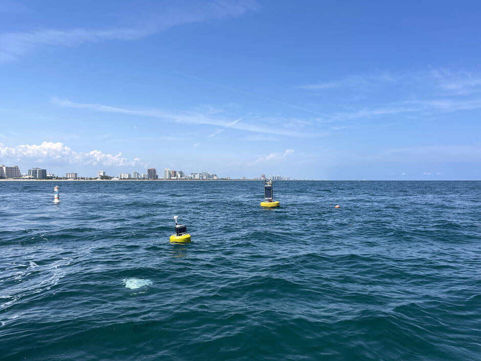
Sediment Monitoring in Port Everglades
To meet the demands of new large marine vessels, the Port Everglades in Florida needs to expand. The US Army Corps of Engineers is leading expansion efforts in the port with dredging planned to start in 2026 to deepen and widen the port to accommodate larger Panamax cargo ships and modern cruise liners. Challenges: Mitigating Environmental Impacts of Dredging The dredging project will displace a large amount of sediment into the water column, which could settle outside of the project area, burying benthic organisms like corals, and possibly carrying harmful particulates to other regions of the world. Dr. Enrique Montes, Associate Scientist of the University of Miami Cooperative Institute for Marine and Atmospheric Studies (CIMAS) affiliated to NOAA’s Atlantic Oceanographic and Meteorological Laboratory (AOML), is overseeing sediment monitoring off the channel of the Port.