
Rain Alert System

From scheduling irrigation in agricultural applications to storm tracking in flood-prone areas or regions with seasonal severe weather, alerting when rain events occur and monitoring rainfall quantity can provide invaluable information. Effective monitoring calls for a reliable, easy to configure, low maintenance rain alert system at an affordable price point so that systems can be deployed on a local basis.
Rain Monitoring
Typical Rain Alert System
Rain events are of great significance in agriculture, flood-prone areas, regions with seasonal severe weather, arid zones, construction sites and even to the general public. NexSens rain alert systems provide accurate measurements and instantaneous alerts. Though rain measurement can be added on almost any NexSens real-time monitoring system, the G2-RAIN Alert System is the primary package delivered for rain monitoring applications.
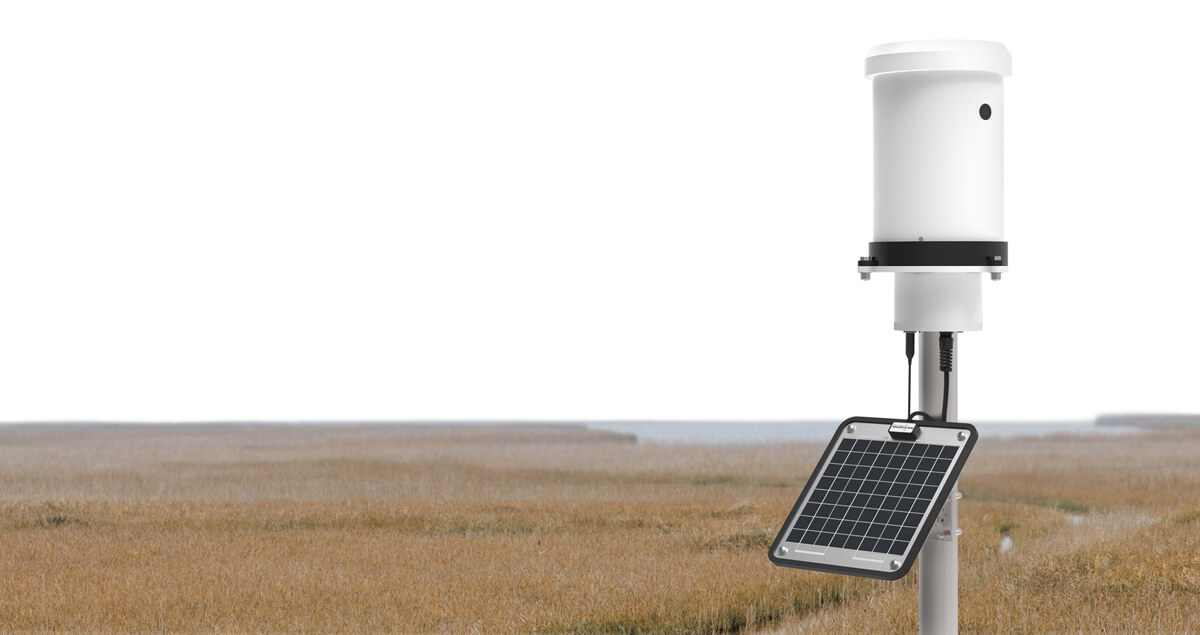
The G2-RAIN is a self-contained rain monitor with an integrated precision rain gauge and real-time data alerts. It transmits accurate rainfall measurements directly to the WQData LIVE cloud-based data management platform using internal power and an embedded cellular modem. Paired with WQData LIVE’s configurable alerts, users are notified of rain events directly on a mobile device or computer. Historical rain data can be viewed, graphed, and downloaded from WQData LIVE for additional analysis.
Integrated tipping bucket and mast-mount features create an easy to set up and simple to maintain monitoring system which can be installed and relocated in minutes. Devices can be configured directly from any web browser without the need for costly site visits and complicated connections.
The G2-RAIN’s included Tipping Bucket Rain Gauge uses a standard 8'' (200mm) diameter receiver that adheres to WMO & NOAA criteria. The rain gauge is the device of choice for accurately measuring low rainfall events and still provides good accuracy when measuring heavier rain events. The collector funnel comes with a stainless steel filter screen to reduce manual maintenance by preventing leaves and other debris from clogging the opening.
Contact a NexSens Applications Engineer today to discuss your rain alert application.


Purchase in the USA
Visit our US distributor, Fondriest Environmental, to purchase online.
Purchase Internationally
Click the button below to find a local distributor.
Contact a NexSens Applications Scientist
Need help designing an Environmental IoT system? NexSens applications scientists will help you design the perfect monitoring system to meet field conditions and monitoring needs.
Case Studies
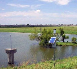
Flood Alert System
In an effort to catch and hold floodwaters in the Plum Creek watershed in Lockhart, Texas, a system of lakes, ponds, and spillways was built beginning in the 1950s. The system allows water to be released at a controlled rate, minimizing damage from heavy rains. The Plum Creek Conservation District monitors, maintains, and improves this system to ensure it works properly, maintaining 28 flood control structures and managing underground water resources in parts of both Hays and Caldwell counties.
Read More About Flood Alert System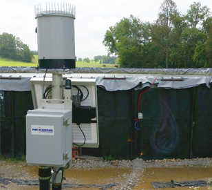
Tracking Water Impoundment Levels
Many energy companies are working throughout the shale gas regions of Pennsylvania and Ohio. One of these is Gulfport Energy, which has some prominent and high-producing wells in Belmont and Monroe Counties in Ohio. Both of the counties are ideally situated in the Marcellus Shale region and have yielded high production rates of natural gas for the company and consumers who rely on natural gas. But along with achieving the quality natural gas yields are a lot of management concerns for Gulfport Energy.
Read More About Tracking Water Impoundment Levels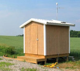
Watershed Monitoring
In order to improve water quality and protect drinking water, researchers at the St. Joseph River Watershed in Indiana are working to identify best management practices that will reduce soil erosion and the amount of nutrients and chemicals in surface water runoff. The research area includes a variety of crop and soil types that undergo different agricultural and water management practices.
Read More About Watershed Monitoring