
Dock Monitoring System

Pre-existing structures such as docks, piers and bridge pilings are great locations for the deployment of a long-term water quality, hydrology, and/or weather monitoring system. Mounting to secure structures cuts down expenses, allows for better accessibility and provides a simple means for gathering valuable weather and water quality data.
Dock Monitoring

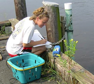
Typical Dock Monitoring System
Dock monitoring systems may incorporate any number of different weather and water quality parameters such as temperature, pH, dissolved oxygen (DO), turbidity, chlorophyll and blue-green algae. Water level, wave and current measurements can also be performed. Central to all of the different types of systems is that docks provide an accessible structure for deployment and maintenance of measurement equipment.
The X3 environmental data logger is the central component of NexSens automated monitoring systems. It is compatible with a wide range of sensor types and manufacturers, detects sensors automatically and can transmit real-time data to the WQData LIVE web datacenter via cellular or satellite telemetry. WQData LIVE has a suite of data management tools and alerts via email or SMS text message.
Flexible mounting options for the X3 logger simplify installation on dock structures. Power is typically supplied with an SP-Series Solar Power Pack. Water quality sensors can be deployed using a perforated deployment pipe mounted onto the dock, giving the advantage of easy accessibility for maintenance and calibration in comparison to a buoy-based deployment.
Almost any industry-standard water quality probes including those from YSI, Hydrolab, Eureka and In-situ are compatible with the X3. Other sensors typically integrated into NexSens dock monitoring systems are weather sensors like those from Vaisala, Airmar and Lufft, the VEGAPULS C 23 radar level sensor for non-contact water level measurement, and side-looking acoustic Doppler current profilers (ADCP).
Contact a NexSens Applications Engineer today to discuss your dock monitoring application.


Purchase in the USA
Visit our US distributor, Fondriest Environmental, to purchase online.
Purchase Internationally
Click the button below to find a local distributor.
Contact a NexSens Applications Scientist
Need help designing an Environmental IoT system? NexSens applications scientists will help you design the perfect monitoring system to meet field conditions and monitoring needs.
Case Studies
Chesapeake Bay Best Management Practices
Because of the roles that shallow areas play in supporting the health of Chesapeake Bay, including serving as productive regions full of grass beds and nursery grounds for juvenile fish, managers with the Maryland Department of Natural Resources (DNR) are understandably interested in keeping tabs on how their conditions change over time. It’s possible to assess some of those by going out at a set interval (daily, weekly, monthly) and gathering water samples to analyze. But such a scheduled approach wouldn’t give managers the around-the-clock data that they really need to get a complete picture of what’s going on in the shallows over time.
Read More About Chesapeake Bay Best Management Practices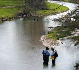
Buck Creek Dam Removal & Restoration
Located in southwest Ohio, Buck Creek and its tributary, Beaver Creek, run through a series of low-head dams in the city of Springfield. Historically, the four dams diverted water for mills and local industry and protected utilities along a continuous four-mile reach. However, they’ve also interfered with the water’s natural flow and inhibited stream health. The Springfield Conservancy District and Friends of the Buck Creek Recreation Corridor are working to restore a more natural flow to the creek while maintaining the benefits provided by the dams. Though planned changes to the dams are primarily for recreational purposes, they will help restore the flow of sediments and fish, as well as provide a healthier ecosystem for Buck Creek. Approved by the U.S. Army Corps of Engineers, removal of one of the low-head dams and modification of another began in the fall of 2009.
Read More About Buck Creek Dam Removal & Restoration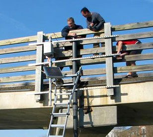
River Water Quality and Automated Sampling System
Located within the quickly developing area of northern Columbus and southern Delaware County, the Olentangy River is a tributary of the Scioto River in Ohio. Despite rapid housing and business development around the Columbus area, the Olentangy River has seen an improvement in water quality, as it was upgraded to an exceptional warm water habitat by the Ohio Environmental Protection Agency. Recently, Ohio State University’s Wilma H. Schiermeier Olentangy River Wetland Research Park contacted NexSens Technology to install a water quality monitoring station with radio telemetry in the Olentangy River.
Read More About River Water Quality and Automated Sampling System