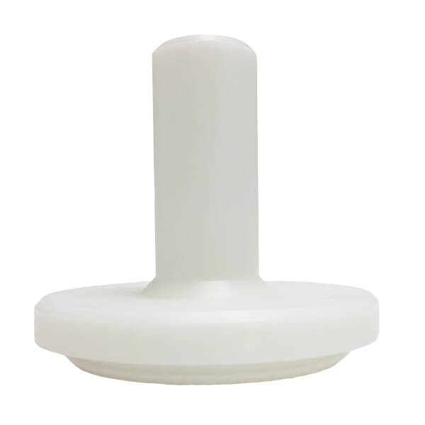
X2-SDL Submersible Data Logger
Features
Rugged
The X2-SDL is designed with impact-resistant PVC, two elastomer bumpers, shock-mounted electronics and redundant seals. It can withstand extreme wave action, floods and underwater deployment to 200 ft.
Rugged
The X2-SDL is designed with impact-resistant PVC, two elastomer bumpers, shock-mounted electronics and redundant seals. It can withstand extreme wave action, floods and underwater deployment to 200 ft.
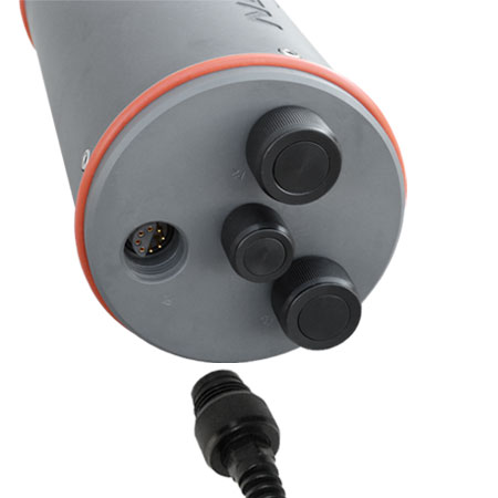
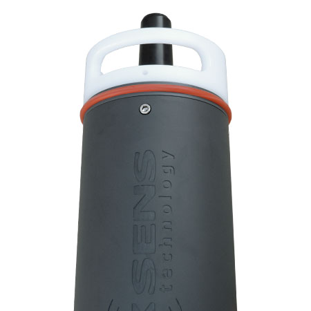
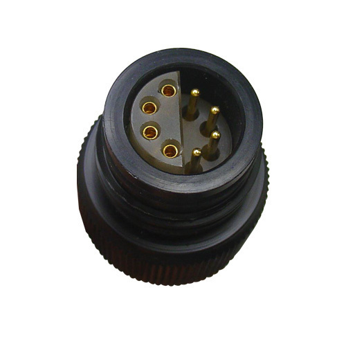
Underwater Connectors
All connections are made with a simple waterproof thread-in connector. This removes the complications and errors associated with connecting individual wires.
Underwater Connectors
All connections are made with a simple waterproof thread-in connector. This removes the complications and errors associated with connecting individual wires.
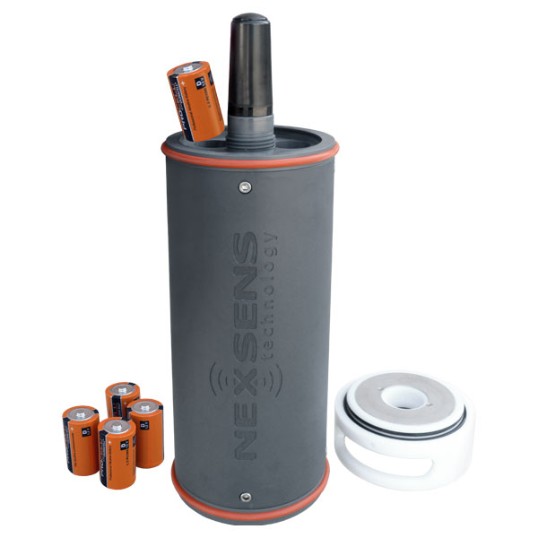
Extended Battery Life
The X2-SDL operates for months on sixteen D-cell alkaline batteries. For longer deployments, extra alkaline battery packs and solar charging options are available.
Extended Battery Life
The X2-SDL operates for months on sixteen D-cell alkaline batteries. For longer deployments, extra alkaline battery packs and solar charging options are available.
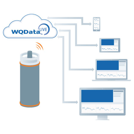
Device-to-Web
When communicating via wireless telemetry, measurement data streams directly to the WQData LIVE web datacenter.
Device-to-Web
When communicating via wireless telemetry, measurement data streams directly to the WQData LIVE web datacenter.
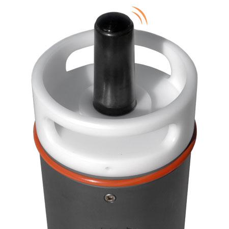
Communication Options
Real-time telemetry options include cellular and Iridium satellite. All communication modules are securely housed within the submersible enclosure, and a waterproof antenna is integrated on the top of the device.
Communication Options
Real-time telemetry options include cellular and Iridium satellite. All communication modules are securely housed within the submersible enclosure, and a waterproof antenna is integrated on the top of the device.
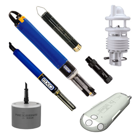
Measurement Versatility
The X2-SDL is configured with three sensor ports to interface with multi-parameter sondes, water quality sensors, temperature strings, Doppler velocity meters, water level sensors, and more. Supported sensor interfaces include SD-12, RS-485 and RS-232.
Measurement Versatility
The X2-SDL is configured with three sensor ports to interface with multi-parameter sondes, water quality sensors, temperature strings, Doppler velocity meters, water level sensors, and more. Supported sensor interfaces include SD-12, RS-485 and RS-232.
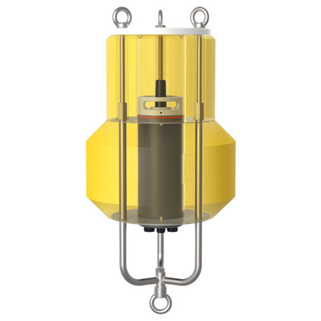
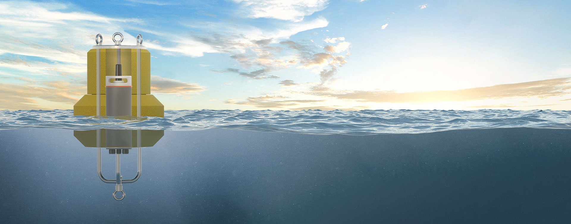
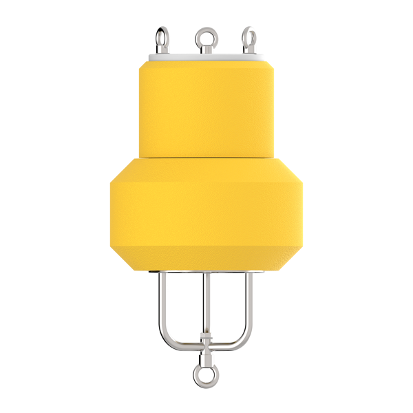
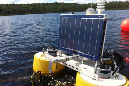
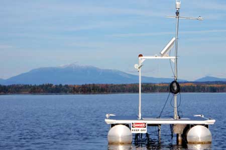
Buoy Integration
The CB-50 data buoy is designed to accommodate the NexSens X2-SDL submersible data logging system for unattended deployment in lakes, rivers, and coastal waters.
Buoy Integration
The CB-50 data buoy is designed to accommodate the NexSens X2-SDL submersible data logging system for unattended deployment in lakes, rivers, and coastal waters.
Documents

Tech Specs
Weight: 12.0 lbs. without batteries; 16.6 lbs. with batteries
Dimensions: 5.5” (13.97 cm) diameter; 17.3” (43.94 cm) length (antenna length varies by model)
Internal Power: 16 user-replaceable D-cell alkaline batteries
External Power Requirements: 5-16 VDC +/-5% (Reverse polarity protected)
Current Draw (Typical @ 12VDC): Low power sleep: 350uA; Active: 45mA; Cellular Transmitting: 300mA; Iridium satellite transmitting: 170mA
Peak Current: Power supply must be able to sustain a 500mA 1-second peak current (@ 12V)
Operating Temperature: -20C to 70°C
User Interface: RS-485 direct to CONNECT Software, WQDatalive Web Datacenter
Data Logging: 256MB microSD card (expandable up to 4GB)
Data Processing: Parameter level polynomial equation adjustment; Basic & Burst Averaging (min, max, standard deviation, and raw data available)
Real Time Clock (RTC): <30sec/month drift1; Auto-sync weekly2; Internal backup battery
Log Interval: User configurable from 1 minute (10 minute default)3; Unique interval per sensor
Transmission Trigger: Time-based, Selective parameter upload option
Sensor Interfaces: SDI-12, RS-232 (3 Channels), RS485
Sensor Power: (3) independent switches from input supply4,5
Built-in Sensors: Temperature (-40C to 85C, 0.1C resolution, ±0.3C accuracy); Humidity (0% to 100%, 0.1% resolution, ±4% accuracy from 5 to 95% RH & -20 to 70C); Battery voltage; System & sensor current
Sensor Ports: (3) 8-Pin for Sensor Interface (RS-232, RS-485, SDI-12, Switched Power, GND)
Power Port: (1) 6-Pin for Power and Communication (Primary/Backup Input, RS-485 Host, GND)
Telemetry Options: 4G LTE cellular, CAT-M1 cellular, Iridium satellite
Antenna Port: Type N female
Notes

Q&A
Get Started
Need help designing an Environmental IoT system? NexSens applications scientists will help you design the perfect monitoring system to meet field conditions and monitoring needs.
Case Studies
Lake Lacawac Profiling Platform
The Lacawac Sanctuary and Biological Field Station overseen by Miami University’s Center for Aquatic and Watershed Sciences is home to lots of exciting research projects. Its namesake, Lake Lacawac, is part of the Global Lakes Ecological Observatory Network, an expansive group of scientists worldwide who study how lakes respond to environmental change. Because of that status, it makes sense that data collected at the sanctuary are used in projects near and far.There are plenty of interesting water quality research projects going on there, relying on gear like secchi disks, handheld meters and plankton nets. But in addition to those, there is new and inventive research afoot at Lacawac Sanctuary.One of those involves a custom auto-profiling platform developed by scientists at Miami University with help from NexSens Technology. It supports topside sensors, as well as a profiler that uses a creative winch system to lower and raise water quality sensors through Lake Lacawac’s water column. Taking that approach, Lake Lacawac investigators are looking to make new finds relating to the interactions between Lacawac’s water and the atmosphere, as well as answer key questions on dissolved organic carbon levels.
Washington Dam Hydrology Tracking
Near the small town of Concrete, Washington, there’s a dam on the Lower Baker River holding back its water. The dam is owned by Puget Sound Energy, a company that delivers electric power and natural gas to customers in the U.S. Northwest.For some time, the hydrology surrounding the dam has been of interest to engineers at the energy company who oversee its operations as part of a hydroelectric asset. In particular, they want to know how water moves in soils and rocks around the Lower Baker Dam.To get at the answers to their questions, officials with the energy company contracted Tetra Tech, an environmental consultant, to devise a hydrology tracking solution. Tetra Tech turned to NexSens Technology for the equipment needed to get the job done. Getting the job done
Monitoring Platform Protects Native Culture
The Penobscot River is at the heart of Penobscot Indian culture. For hundreds of years, the tribe has looked on it as a source for food and medicine, as well as a means of transportation. But in recent years, algal blooms have gotten worse in the river, believed to be caused by phosphorus discharges from a paper processing plant.Not long after the plant was fined and ceased operations, the Penobscot Indian Nation secured funding to launch a water quality monitoring platform on the river. The platform serves as a guardian both to the Penobscot River and to the culture that still thrives around it today.The platform was deployed in Dolby Pond, one of the Penobscot River’s impoundments. It launched in 2007 after an especially bad algal bloom that was connected to the paper mill upstream. After a short boat ride out to it, the floating platform allows workers with the Penobscot Nation’s Water Resources Program to check on monitoring equipment at a comfortable standing position. It was built by the Nation as a hands-on project that helped connect tribe members to the effort by giving them a way to chip in.