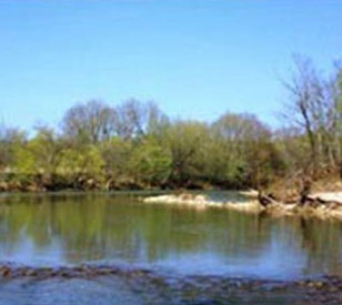
 Located in southwest Ohio, the Edge of Appalachia is the largest privately owned nature preserve in Ohio and provides critical habitat for rare species of plants and animals. Ohio Brush Creek, a tributary of the Ohio River, runs through the preserve and is home to several species of endangered freshwater mussels.
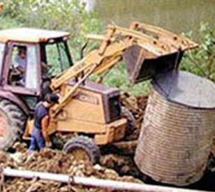
To document long-term trends in water quality and rainfall on the preserve, a monitoring system was installed that allows real-time collection of data. This real-time connection, supported by NexSens data loggers and software, allows the preserve to “take the pulse” of the creek for the benefit of students, visitors, and researchers.
Real-Time Water Quality Data at the Preserve
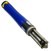
Conductivity, dissolved oxygen, pH, and turbidity sensors were selected for water quality monitoring. A YSI sonde offers the latest in water quality sensor technology. The dissolved oxygen probe features a pulsed technology that eliminates the need for stirring. The turbidity sensor includes a self-cleaning wiper that allows long-term deployments with minimal maintenance requirements.
An RM Young 52203 Rain Gauge monitors rainfall. The model 52203 is a pulse-counting rain gauge that is designed for long-term deployments in real-time monitoring networks. The addition of precipitation data allows researchers to document the impact of storm events on river water quality.
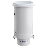
A NexSens data logger was chosen to communicate with the remote water quality monitoring site. The logger allows real-time communication with remote instruments that are located near a landline phone connection.
NexSens iChart software automatically queries the field sites on a pre-defined schedule. iChart provides a point-and-click interface for multi-site, multi-vendor real-time environmental monitoring networks.
Reports can be automatically generated to analyze long-term water quality and precipitation trends. Custom data reports can be automatically generated and distributed by web posting, email, or network folder access. Alarms can also be easily set up, allowing immediate notification when any parameter is outside of a pre-defined range.
The combination of fouling-resistant water quality sensors and real-time telemetry ensures that quality data is collected for long-term applications. Real-time data allows personnel at the center to educate school groups about river water quality and its impact on the ecology of the native organisms inhabiting the site.
Customer Testimonial
“The NexSens remote telemetry setup has been extremely reliable and easy to use. NexSens telemetry allows me to have my coffee in the morning and view real-time creek data in my office while others are wet and freezing in the field with handheld equipment. And NexSens software will allow us to send creek data to the museum’s downtown Cincinnati location for 1.4 million visitors to view.”
— Chris Bedel, Preserve Director
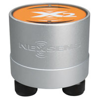
The NexSens X2 Environmental Data Logger offers the latest in real-time monitoring technology with wireless communication, large plug-and-play sensor library, and ultra-low power consumption.
The NexSens G2-RAIN Alert System incorporates a precision rain gauge with cellular data communication and real-time notifications.