 Sediment in the Spring Creek Arm of the Keswick Reservoir in California previously contained high concentrations of copper and zinc, the source of which was contaminated runoff from the Iron Mountain Mine Superfund Site.
In order to protect the downstream Sacramento River ecosystem, which is a valuable commercial fishery and critical habitat for several endangered or threatened species, the Environmental Protection Agency has conducted a two-phase dredging project to remove the contaminated sediment. The first was completed between October and December 2009, and the second between April and June 2010.
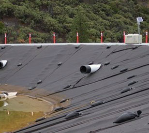
A barge-mounted hydraulic dredge was used to remove the contaminated sediment, which was pumped from the Spring Creek Arm through a pipeline to a disposal cell located northwest of Spring Creek Reservoir and then treated with lime slurry and polymer.
During dredging operations, water quality was monitored in the Keswick Reservoir, the Sacramento River, and at the disposal cell discharge location using a NexSens real-time monitoring solution.
Buoy network watches water quality
 Field measurements of turbidity, pH, conductivity, dissolved oxygen, and temperature were collected every 10-minutes at five locations, four of which were based on NexSens MB-300 data buoys.
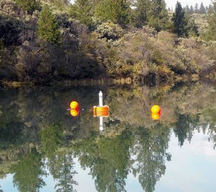
A background buoy was placed between 1,000 and 2,000 feet upstream from dredging operations in the Keswick Reservoir. An early warning buoy was installed 300 feet downstream of the work area. Finally, two receiving-water compliance buoys were installed downstream from the work area, one 500 feet downstream and the other located as far as 3,000 feet downstream, to comply with monitoring requirements for metals. Each monitoring buoy was equipped with an SDL submersible data logger with real-time radio telemetry.
Additionally, a shore-based sampling station was installed downstream of the disposal cell for compliance monitoring. The site was equipped with a NexSens data logger with radio telemetry.
All monitoring stations were equipped with YSI multiparameter water quality sondes and were completely powered by on-board solar panels.
Two repeater stations, one buoy-based and another land-based, helped ensure that all stations were able to communicate with the base of operations, located in a nearby trailer. There, a computer running NexSens iChart software receives and processes all remote data.
Results for 10-minute field measurements made in the Keswick Reservoir and the disposal cell were then reported on a NexSens WQData Web datacenter site, where project members can view and analyze information at any time from anywhere using nothing but an Internet browser.
WQData allows for the display of historical data, graphing, offers numerous analysis tools, and also generates a map overlaid with real-time data from all monitoring sites.
With this comprehensive monitoring network in place, project members were able to ensure the dredging and treatment process did not endanger nearby water quality.
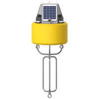
NexSens CB-150 Data Buoy

NexSens X2-SDL Submersible Data Logger The X2-SDL Submersible Data Logger is a rugged, self-powered data logging system with optional cellular, satellite, or radio communications. 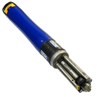
YSI EXO2 Multi-Parameter Water Quality Sonde The YSI EXO represents the next generation of water quality instruments from YSI. The EXO2 sonde includes six sensor ports and a central anti-fouling wiper option. 
NexSens WQData LIVE Web Datacenter WQData LIVE is a web-based project management service that allows users 24/7 instant access to data collected from remote telemetry systems. |